The hike starts in forest terrain, but quickly climbs up the hillside and gradually opens up with views of the valley. Along the way, you'll pass logging fields, old tractor roads and clear cultural traces in the terrain. Tjuvkjellaren is rumoured to have been used as a hiding place in the old days. 500 metres from Tjuvkjellaren is a viewpoint with a postbox and panoramic views of the villages below.
Car park
The tour starts at the shooting range in Oppheim, where it is possible to park.
Hike description
Start at the shooting range in Oppheim. The first part of the trail does not follow the original route, but you follow a clear path through a logging field and over a tractor road, before entering the old road between Oppheim and Liagardane. This is where the climb begins in earnest. It's a good path, but steep up the hillside.
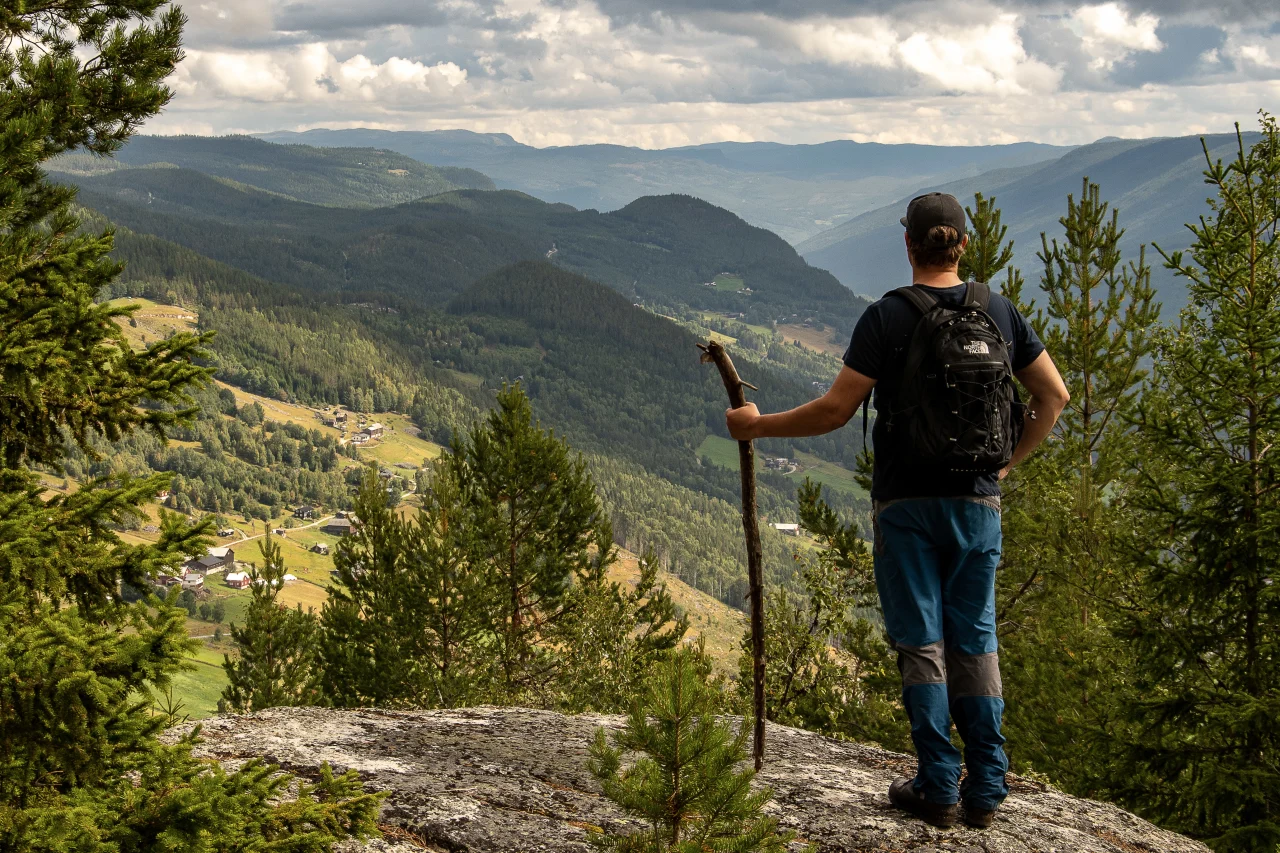
After passing Tjuvkjellaren, a formation with a mysterious history and an intriguing name, you continue about 500 metres up to the viewpoint, where you'll find the mailbox and guest book. From here you'll have a wonderful view of Oppheim, Torpo and the open landscape of Hallingdalen.
You can return the same way or choose to go down via Liagardane, to make the trip a round trip.
Tips
The tour follows part of the old road that for over a hundred years was the main route from Oppheim to Ål town centre, and was in use right up until the 1960s. This makes the tour a cultural journey in addition to the nature experience.
On Geiteryggen, not far away, there is also an old trapping pit between two vertical rock walls. It is bricked up at both ends and was probably used to catch wild reindeer or deer in earlier times.
If you want to stay overnight in the area, we recommend a stay at Oppheim Guest House, an authentic and personalised place with roots dating back to the 1930s.
Map
- Ut.no
- Cycling and hiking map, Hemsedal, Gol and Ål 1:60 000
- Reineskarvet 1:50,000.