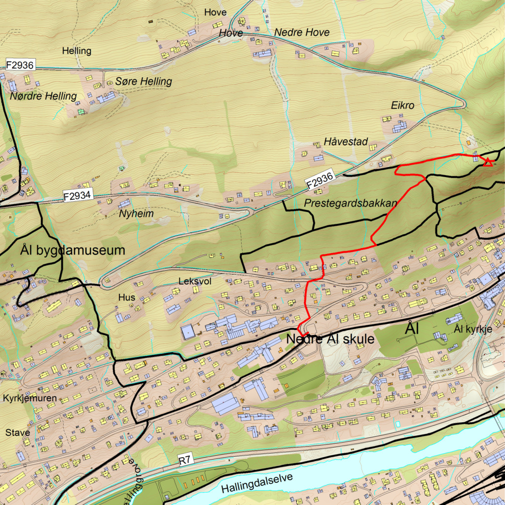
Car park
Drive west on Sundrevegen out of Ål town centre, past the church and up the hill. Park at the top of the small hill, in the square on the right.
Hike description
From the car park, walk approx. 200 metres along Øvre-Ålsvegen. At the junction with Orelivegen, you'll find a sign pointing the way to Sundreberget. Follow the path - it is well marked and easy to walk.
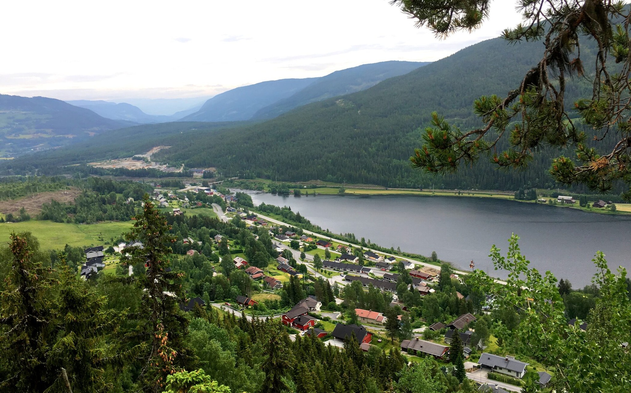
Approximately 20 metres before the viewpoint itself, you'll find a mailbox with a guest book. Along the way, you'll pass information boards telling you about the area's nature, geology and former forestry operations. You'll also pass through Forest park, operated by Ål Rotary - here you can see traces of old coal pits.
You can choose to walk back the same way, or take a short loop via the tractor road from Skogparken that goes down to Øvre-Ålsvegen. From there, follow the road back to the school area. If you want a slightly longer hike, you can continue over Sundreberget in the direction of Øvre-Ål and follow a circular trail back to the lookout point.
Map
- UT.no
- Reineskarvet 1:50 000